Ho Chi Minh City "Awakens" the Potential of the Northwest Region
In contrast to the rapid development of the southern area, the northwest region of Ho Chi Minh City has long remained untapped, failing to realize its potential and advantages. Shifting focus and investing to "awaken" this urban area is now the approach the city is pursuing.
NEWS
Vũ Nguyên/ Nhan Dan Newspaper
4/19/20203 min read
Transportation as the Catalyst
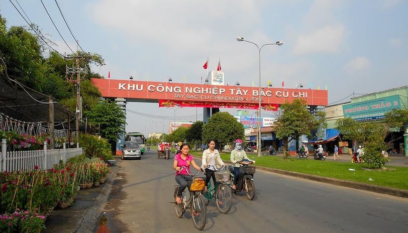
According to the master plan approved by Ho Chi Minh City, the northwest urban area is located within Cu Chi and Hoc Mon districts, covering more than 9,000 hectares. It is designated to become a city-level hub for commerce, healthcare, sports, and other services, with 11 functional subdivisions, including public centers, commercial zones, service areas, healthcare facilities, industrial zones, and logistics centers. Despite its importance and scale, and the approval of multiple urban development projects, progress has been slow. Facing various challenges, investors have had to scale down their projects, and some have even returned their investment licenses. As a result, after more than 10 years of planning, the urban area has yet to take shape.
According to economic experts, the primary reason for the area's underdevelopment is the lack of transportation connectivity to the city center. Currently, access to the area is mainly via National Highway 22, which has been severely overloaded for years, causing frequent traffic congestion at key gateways. Another reason for the northwest's slow development is that Ho Chi Minh City has, for many years, focused mainly on the development of its southern and eastern areas, relegating the northwest to a secondary growth direction despite its demographic and geographic potential.
Nguyen Van Tam, Deputy Director of the Ho Chi Minh City Department of Transport, stated that transportation infrastructure acts like a "magic wand" to unlock the northwest region’s development. To boost the local economy, there is no other option but to invest in transport infrastructure. In recent years, the city has invested in several radial roads such as National Highway 22, Phan Van Hon Road, Provincial Road 9, and Provincial Road 15. One key project aimed at alleviating congestion at the northwest gateway is the An Suong Interchange (District 12), which is under accelerated construction. Once completed, it will ease traffic flow along the major arterial routes connecting Ho Chi Minh City with the southeastern and southwestern provinces, as well as from the city center to Cu Chi District and Tay Ninh Province.
A Shift in Development Strategy
Speaking with us, Nguyen Thanh Nha, Director of the Ho Chi Minh City Department of Planning and Architecture, explained that under the General Master Plan Adjustment approved by the Prime Minister in 2010, the city’s development was oriented toward two primary directions — east and south toward the sea — and two secondary directions — northwest and west-southwest. However, in the context of climate change and rising sea levels, the city's development directions need to be reassessed. The focus should shift towards the east, an area with favorable geological, hydrological, and land conditions for synchronous and comprehensive urban development. This area also connects with Long Thanh Airport and regional growth hubs like Bien Hoa and Nhon Trach.
At the same time, the city is considering prioritizing development toward the northwest due to the abundance of available land for urban expansion and relatively low land prices, offering connectivity to Tay Ninh Province and Moc Bai Border Gate. Additionally, the city will continue to promote the development of Hiep Phuoc Port Urban Area as planned, aiming to establish an integrated industrial park and logistics hub in the south. Eco-tourism development will also be incorporated into the land reclamation project at Can Gio District, with careful attention to sustainable urban development given the area's ecological sensitivity amid climate change.
Commenting on the city's strategic shift, Le Hoang Chau, Chairman of the Ho Chi Minh City Real Estate Association, emphasized that pivoting development towards the northwest is essential to cope with global climate change and rising sea levels, as Ho Chi Minh City is among the most vulnerable locations. Much of the city lies at low elevations, ranging from just 0.5 meters above sea level in Nha Be and Can Gio Districts to about 32 meters at Long Binh Hill in District 9. Low-lying areas in the south, southwest, and southeast include Nha Be, Binh Chanh, Districts 7, 8, 2, part of District 9, and Can Gio District. Conversely, higher areas are found in the north, northeast, and northwest — Cu Chi, Hoc Mon, District 12, and Go Vap. The city's terrain slopes downward from the northwest to the southeast. The Saigon River's semi-diurnal tide regime further complicates drainage. According to projections, if sea levels rise by just 0.5 meters, many parts of Ho Chi Minh City could be submerged.
For sustainable development, the city must build key transportation corridors. One crucial project is the proposed Saigon River Parkway, stretching from Ben Suc (Cu Chi District) through Hoc Mon District, District 12, Go Vap, Binh Thanh, and into District 1. This project, currently awaiting investment approval, is vital for revitalizing a long-neglected area. Once planned and implemented properly, this parkway will provide an additional parallel route to National Highway 22 (the Trans-Asia Highway), linking via Provincial Road 8 and other lateral roads. It will help stimulate socio-economic development across the city's northwest and extend its impact to neighboring districts like Thuan An and Ben Cat (Binh Duong Province), Duc Hoa (Long An Province), and Trang Bang (Tay Ninh Province).
